ADOT Road Closures Flagstaff: Guide & Live Tools
Sitting at an elevation of 7,000 feet, Flagstaff serves as the northern crossroads of Arizona. Millions of drivers pass through this mountain hub each year, whether commuting between Phoenix and the high country, hauling freight along Interstate 40, or visiting the Grand Canyon. However, because of severe alpine weather, steep mountain grades, and seasonal highway maintenance, checking for adot road closures flagstaff motorists might face should always be your first step before getting behind the wheel.

The Arizona Department of Transportation (ADOT) manages thousands of miles of state and interstate highways in Northern Arizona. When extreme weather strikes or major collisions occur, closures can happen fast and last for hours. Knowing where to find real-time information, understanding which routes are most vulnerable, and packing the right emergency supplies can mean the difference between a smooth trip and being stranded on a frozen mountain pass.
How to Check Real-Time ADOT Road Closures in Flagstaff
Before heading up the mountain or leaving town, rely on official state channels rather than third-party navigation apps, which often lag behind emergency decisions made by highway patrols.
- AZ511 System (az511.gov or the AZ511 Mobile App): This is ADOT’s primary real-time traveler information portal. It shows active lane restrictions, complete closures, average travel speeds, and direct feeds from highway cameras scattered across Flagstaff, Bellemont, Munds Park, and along the Mogollon Rim.
- ADOT Alerts App: A free app designed to send geolocated audio push notifications directly to your phone when major highway shutdowns happen in your immediate vicinity.
- Social Media Updates: The ADOT communications team runs an active account on X (formerly Twitter) at
@ArizonaDOT. During winter blizzards and high-impact incidents, staff post frequent updates on highway conditions, detour guidance, and estimated reopening times. - Overhead Dynamic Message Signs: Watch electronic signs along I-17 and I-40. They provide vital, immediate warnings regarding road shutdowns, severe crosswinds, and traction requirements miles before you reach a choke point.
Major Flagstaff Corridors Most Prone to Closures
Flagstaff sits at the intersection of several critical transportation arteries. Because surrounding topography varies from dense pine forest to open high desert, each corridor presents distinct hazards.
Interstate 40 (East and West)
I-40 is one of the nation’s heaviest freight corridors. Spanning east toward Winslow and west toward Williams and Kingman, this stretch experiences severe crosswinds, heavy snowfall, and blowing drift ice during winter. Jackknifed semi-trucks frequently trigger full closures between Ash Fork and Flagstaff. In winter, ADOT sometimes institutes rolling closures to allow snowplows to work safely without traffic interference.
Interstate 17 (South to Phoenix)
Connecting the desert floor to Flagstaff’s mountain plateau, I-17 gains over 5,000 feet of elevation in less than 50 miles. The section between Sedona (SR 179 junction) and Flagstaff—particularly near Stoneman Lake and Munds Park—frequently freezes while Phoenix is experiencing mild rain. Sudden shifts from wet asphalt to black ice cause numerous slide-offs, often forcing ADOT to close northbound lanes at Camp Verde or Sedona Vista.
US Route 180 (To Arizona Snowbowl and the Grand Canyon)
US 180 runs northwest out of Flagstaff past Arizona Snowbowl toward Valle. This two-lane highway routinely clogs with ski traffic on winter weekends. Heavy snow accumulation in the San Francisco Peaks often leads to single-lane restrictions or extended closures when vehicles without adequate snow tires or four-wheel drive spin out and block travel lanes.

State Route 89A (Oak Creek Canyon)
Connecting Flagstaff to Sedona, SR 89A navigates tight switchbacks down a steep canyon wall. During winter, shaded corners stay packed with slick ice for days. In the spring and monsoon seasons, rockslides and falling debris occasionally shut this scenic route down completely, requiring detours via I-17 and SR 179.
Navigating ADOT Road Closures Flagstaff Drivers Face in Winter
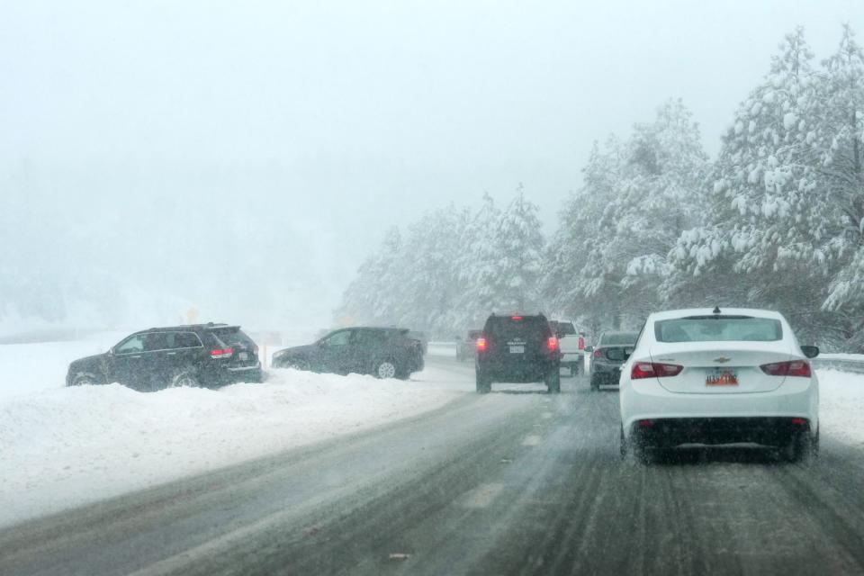
Northern Arizona winter storms are notoriously intense. Flagstaff averages roughly 100 inches of snow annually, with surrounding peaks receiving significantly more. When storms hit, ADOT focuses on life safety and keeping essential supply lines moving.
ADOT deploys dozens of snowplows equipped with tow plows that can clear two full lanes at once. It is illegal and dangerous to pass a snowplow on the right, or to pass any plow until the operator pulls aside. If visibility drops to zero due to whiteout conditions, ADOT and the Arizona Department of Public Safety (DPS) will close on-ramps and set up physical barricades.
Never bypass a highway closure barrier. Driving around a "Road Closed" sign in Arizona can lead to substantial fines under the state's statutes, and if you require search-and-rescue assistance after ignoring a barricade, you could be billed for the full cost of the rescue operation.
Summer Construction, Wildfires, and Monsoon Impacts
Winter isn't the only season that disrupts Flagstaff traffic. Summer brings a different set of challenges that drivers must anticipate:
- Pavement Preservation Projects: Due to extreme freeze-thaw cycles, Flagstaff roads deteriorate faster than desert highways. ADOT conducts extensive repaving, bridge maintenance, and diamond grinding projects during warmer months, leading to lane reductions and ramp closures on both I-40 and I-17.
- Wildfires and Smoke Hazards: Northern Arizona's vast ponderosa pine forests are prone to seasonal wildfires. Dense smoke blowing across the highway can lower visibility to near zero, forcing precautionary closures by ADOT and the U.S. Forest Service.
- Monsoon Flooding and Debris: Summer monsoon storms frequently drop heavy rain on recent burn scars around the San Francisco Peaks. Fast-moving flash floods carrying mud, logs, and boulders have previously overwhelmed drainage culverts and forced emergency closures on US 89 north of Flagstaff.
Essential Preparation Checklist for High-Country Travel
In mountain regions, a road closure rarely has a simple, quick detour. Many alternate forest service roads are completely impassable in winter and lack cellular service. If you encounter an unexpected closure, your best option is often to wait it out in a safe, designated parking area or return to town.
- Inspect Your Vehicle: Check that your tires have adequate tread depth. Arizona does not mandate snow chains for passenger vehicles by default, but having snow-rated tires (M+S or 3PMSF ratings) or carrying tire chains is vital during winter advisories. Keep your windshield washer fluid topped up with a low-temperature, de-icing formula.
- Pack an Emergency Kit: Keep blankets, sleeping bags, extra winter coats, gloves, high-protein snacks, bottles of water, a flashlight, and a first-aid kit inside your passenger cabin—not locked away under luggage in the trunk.
- Maintain a Full Tank: Never let your fuel level drop below a half-tank while driving through the high country. If an accident or sudden closure strands you on the interstate for several hours, you will need that fuel to run the engine periodically for cabin heat.
- Carry Portable Power: Cold weather drains mobile phone batteries rapidly. Always keep a charged portable battery pack in the car so you can monitor AZ511 updates or contact roadside assistance if necessary.
Flagstaff’s roads are scenic, essential, and sometimes challenging. By staying informed through ADOT's monitoring systems and keeping your vehicle prepared for sudden shifts in weather, you can navigate Northern Arizona's highways safely no matter what the season brings.