Baltimore Canyon Marine Forecast & Offshore Guide
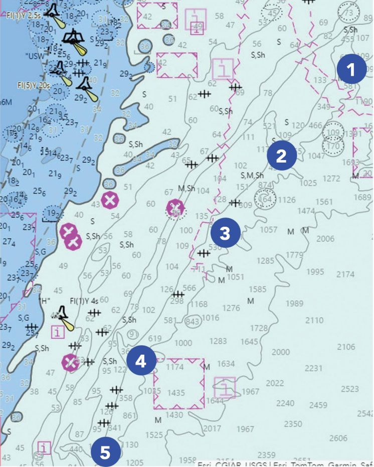
Running to the edge of the continental shelf requires meticulous preparation, and checking the baltimore canyon marine forecast is the single most critical step before untying the dock lines. Sitting roughly 65 to 70 nautical miles east-southeast of Ocean City Inlet, Maryland, and about the same distance from Cape May, New Jersey, the Baltimore Canyon marks a dramatic drop-off where the seabed plunges from 50 fathoms (300 feet) to well over 1,000 fathoms. This dramatic bathymetry creates world-class pelagic fishing for tuna, billfish, and mahi, but it also creates volatile, unforgiving sea conditions when ocean weather shifts.

Whether you are running a 60-foot custom sportfisher or a twin-engine center console, interpreting offshore weather requires looking far beyond a basic coastal app. Understanding open-ocean wave physics, Gulf Stream dynamics, and specific marine reporting zones is essential for a safe and productive offshore trip.
Decoding the Baltimore Canyon Marine Forecast: Key Metrics
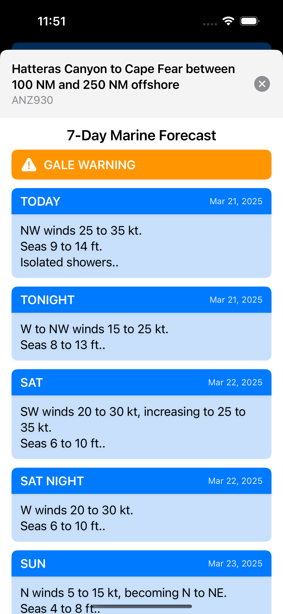
Standard marine weather broadcasts divide waters into inshore, coastal (out to 20 or 40 nautical miles), and offshore zones. The Baltimore Canyon sits firmly in NOAA’s offshore waters forecast, falling within the zone designated as ANZ083 (Hudson Canyon to Baltimore Canyon) and bordering ANZ084 (Baltimore Canyon to Hatteras Canyon out to 1,000 fathoms).
When reviewing the offshore forecast, prioritize these three interconnected elements:
- Significant Wave Height vs. Dominant Period: Significant wave height represents the average height of the highest one-third of waves. That means individual waves can easily measure up to double the forecasted height. The dominant wave period (measured in seconds) determines the steepness of the seas. A 4-foot sea at 9 seconds is an easy, rolling swell; a 4-foot sea at 4 seconds creates tightly spaced, violent square waves that will rattle your hull and crush fuel efficiency.
- Wind Wave vs. Swell: Always look at the directional relationship between local wind chop and underlying groundswell. If a 15-knot south wind creates a 3-foot chop that opposes an incoming 4-foot southeast groundswell, the sea state becomes chaotic and confused.
- Forecast Model Variance: Never rely on a single computer model. Compare the high-resolution GFS (Global Forecast System), ECMWF (European model), and short-range models like the NAM (North American Mesoscale) or HRRR (High-Resolution Rapid Refresh) for the first 12 to 24 hours of your trip. Consistency across multiple models indicates high forecast reliability.
The Impact of Gulf Stream Eddies and Water Temperature
The Baltimore Canyon’s productivity relies on oceanographic circulation, particularly warm core rings (eddies) that break off from the Gulf Stream and spin clockwise across the continental slope. While these warm blue fingers push bait and pelagic gamefish onto the 100-fathom curve, they radically alter the local marine weather.
The Danger of Wind Against Current
Because warm core rings rotate clockwise, the eastern or western side of the canyon can feature currents running anywhere from 1.5 to 3 knots. When a sustained wind blows directly opposite this strong ocean current, wave energy compresses. A manageable 15-knot northeast wind blowing into a 2.5-knot northward current will quickly stack 3-foot waves into steep, breaking 6-footers with virtually no interval between crests. Always correlate surface current velocity and direction with your wind forecast.
Marine Fog and Temperature Inversions
In spring and early summer, offshore waters present a stark contrast: cold inshore green water (50°F to 60°F) collides with warm offshore Gulf Stream water (72°F+). When warm, humid southwest air masses blow across these colder shelf waters, moisture condenses into dense sea fog. Navigating the Baltimore Canyon under zero-visibility conditions requires functioning radar, active AIS (Automatic Identification System), and a dedicated thermal or visual watch.
Key Buoys and Real-Time Observation Tools
Video: KEC92 Broadcast Cycle

Forecast models predict what should happen; buoys tell you what is happening right now. Before departing, check real-time data from the National Data Buoy Center (NDBC) and regional ocean observing systems to verify whether conditions are matching, lagging, or exceeding the forecast.
- NOAA Buoy 44009 (Delaware Bay): Located 26 nautical miles southeast of Cape May, this buoy provides an early baseline of shelf conditions, wind speed, wind gusts, and dominant wave period before you cross past the 30-mile mark.
- NOAA Buoy 44066 (Texas Tower #4): Positioned 75 nautical miles east of Long Beach, NJ, near the shelf edge. While north of Baltimore Canyon, it offers critical insights into deep-water Atlantic groundswells moving south along the shelf break.
- Satellite SST and Chlorophyll Imagery: Platforms such as RipCharts, Roff’s, or SatFish provide cloud-free satellite imagery of surface temperatures and water clarity. Identifying sharp temperature breaks (e.g., 68°F to 74°F across a two-mile span) highlights where fish hold and where current shear will affect sea states.
Seasonal Forecast Trends in the Baltimore Canyon
The weather profile at the shelf break shifts significantly throughout the offshore season:
Early Season (May to June)
This period brings migrating bluefin, yellowfin, and mako sharks, but weather windows are brief. Deep low-pressure systems moving off the coast can linger, generating long-period swells. Sea fog is at its peak during late spring as warm fronts slide across cold ocean water.
Mid-Summer (July to August)
The Bermuda-Azores High typically settles in, producing light morning winds and long, calm stretches ideal for running 60+ miles. However, heat-driven afternoon thunderstorms are common. Mid-Atlantic summer squalls can generate sudden 40-knot downdrafts and severe lightning over the canyon, often with less than 30 minutes of warning.
Fall (September to November)
Fall delivers legendary chunking and swordfish action, but it requires the greatest caution. Rapidly intensifying continental cold fronts sweep off the coast with little warning, and distant tropical systems hundreds of miles away in the Atlantic can send massive, long-period swells that turn inlet bars into breaking shoals on your return.
Offshore Safety and Go/No-Go Planning
Because the Baltimore Canyon is roughly a 2- to 3.5-hour run each way for most vessels, your weather window must accommodate the entire duration of the trip—not just your arrival time. Maintain disciplined planning protocols:
- The Rule of Thirds for Fuel: Calculate one-third of your total usable fuel to run out, one-third to troll or drift, and one-third in reserve for the return leg. Heavy head seas can drop your cruising fuel economy by 30% or more.
- Set Inviolate Go/No-Go Thresholds: For vessels under 35 feet, sustained winds over 15 knots or wave periods shorter than the wave height (e.g., 5 feet at 5 seconds) should generally trigger a cancellation.
- Check Inlet Tides: A clean offshore day can still turn hazardous at the inlet mouth. Running back into Ocean City Inlet or Indian River Inlet on an outgoing tide against an incoming easterly sea produces steep standing waves across the shoals.
- Independent Satellite Communications: Cell reception ends roughly 15 to 20 miles offshore. Ensure your vessel is equipped with a functioning satellite messenger (such as an inReach or ZOLEO), an EPIRB/PLB, and fixed-mount marine VHF with DSC connected to GPS.
By closely tracking marine zones ANZ083 and ANZ084, watching wave periods rather than just wave heights, and respecting the interactions between Gulf Stream eddies and opposing winds, you can make informed decisions that ensure every trip to the Baltimore Canyon is safe, efficient, and successful.