Bexar County Crime Map: How to Find Local Safety Data
Understanding local safety is crucial whether you are moving to a new neighborhood, renting a property, or simply keeping tabs on your community. For residents of San Antonio and the surrounding areas, utilizing a Bexar County crime map is one of the most effective ways to review historical incident reports, spot local trends, and make informed decisions.

Because Bexar County spans a massive geographic area encompassing both dense urban neighborhoods and sprawling rural communities, crime patterns vary significantly from one zip code to the next. This guide explains how to access public safety tools, interpret official reporting data, and evaluate crime statistics responsibly.
How to Access Official Bexar County Crime Data
Public safety transparency has improved dramatically over the last decade, giving citizens direct access to law enforcement dashboards. Depending on the exact location you want to research, data usually comes from two primary jurisdictions: the Bexar County Sheriff's Office (BCSO) and the San Antonio Police Department (SAPD).
Bexar County Sheriff's Office Resources
If you live in an unincorporated area of the county or outside city limits, the BCSO handles law enforcement. While the sheriff's office does not always provide a real-time, interactive pin-drop map directly on its homepage due to privacy and ongoing investigation restrictions, they do participate in regional data-sharing networks. Residents can submit open-records requests or utilize state-level clearinghouses to view comprehensive county reports.
San Antonio Police Department Crime Viewer
Video: Safety at your fingertips: New BCSO app includes a map of registered sex offenders, family resources

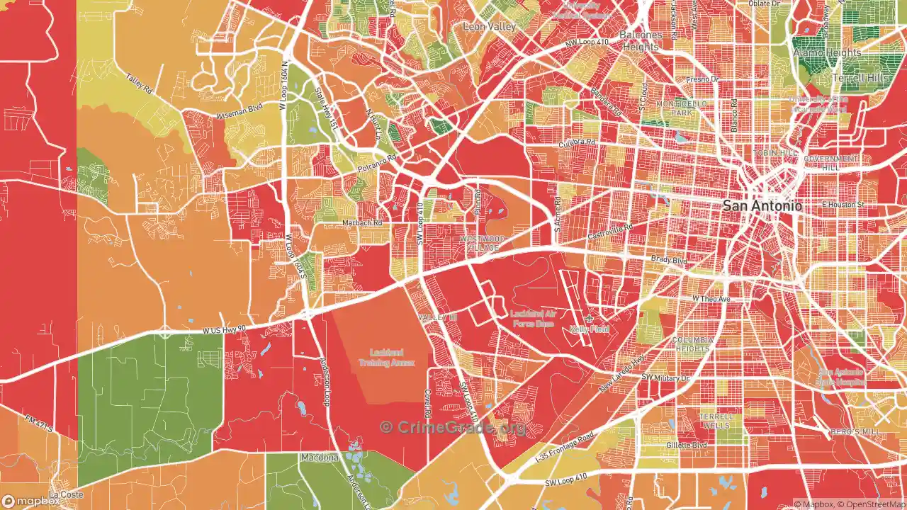
Because San Antonio makes up the vast majority of Bexar County's population, many people searching for county data are actually looking for city limits. The SAPD provides public-facing crime mapping tools and periodic updates through open data portals. These tools allow users to filter incidents by category, such as property crimes, violent offenses, and traffic accidents, over specific date ranges.
Interpreting a Bexar County Crime Map Effectively
Looking at raw data points on a map can sometimes cause unnecessary alarm if you do not know how to analyze the information properly. When reviewing any crime reporting tool in South Texas, keep the following factors in mind:
- Property Crime vs. Violent Crime: The vast majority of reported incidents on any map relate to property crimes, such as vehicle break-ins, package thefts, and minor vandalism, rather than violent offenses. Distinguishing between these two categories helps provide a realistic view of neighborhood risk.
- Reporting Lags: Most online crime maps do not display live dispatches in real-time. There is typically a verification and processing lag of anywhere from 24 hours to several days before an incident appears on a public database.
- Geographic Concentration: Crimes often cluster heavily around commercial corridors, major highway interchanges, and high-traffic retail centers rather than residential side streets. A high concentration of pins near a shopping mall does not necessarily mean the surrounding residential neighborhoods experience high crime rates.
Alternative Tools for Checking Neighborhood Safety
If official law enforcement portals do not provide the granular street-level view you need, several alternative resources can help paint a clearer picture of Bexar County neighborhoods:
- Third-Party Aggregators: Platforms like SpotCrime or CrimeMapping pull local police logs and display them on interactive Google Maps interfaces. While convenient, always cross-reference these with official police department logs for absolute accuracy.
- Local Community Networks: Neighborhood-specific groups on apps like Nextdoor offer hyper-local insights. While anecdotal and prone to subjective exaggeration, neighbors often share immediate warnings about suspicious activity, package thefts, or aggressive stray animals.
- Sex Offender Registries: The Texas Department of Public Safety maintains a publicly searchable database tracking registered sex offenders by address, zip code, and radius.
Using Crime Data Responsibly When Moving
If you are using a Bexar County crime map to scout a potential home purchase or rental lease, remember that numbers alone do not tell the whole story. Visit the neighborhood at different times of day—early morning, mid-afternoon, and late evening—to observe foot traffic, lighting, and general upkeep. Speak directly with prospective future neighbors about their personal experiences with local security, property management responsiveness, and community watch programs. Combining digital mapping tools with on-the-ground observation ensures you get an accurate, balanced assessment of any area in Bexar County.