Chance of Rain in San Diego: What to Expect
When people think of Southern California, they typically picture endless sunshine, palm trees, and sunscreen-slathered beachgoers. While that image holds true for the vast majority of the year, visitors and new residents often wonder: what is the actual chance of rain in San Diego? Understanding this city's unique precipitation patterns can help you pack better, plan outdoor events, and appreciate why San Diego is famous for having one of the best climates in the United States.

San Diego's Mediterranean Climate
San Diego features a semi-arid Mediterranean climate. This means the region experiences warm, dry summers and mild, relatively damp winters. However, the term "damp" is used lightly here compared to the Pacific Northwest or the East Coast. The city averages only about 10 to 13 inches of rain per year along the immediate coast, making it one of the driest major cities in the country.
Rain is not distributed evenly across the calendar. Instead, it is heavily concentrated in a handful of winter months, while summer and early fall are practically bone-dry. If you are visiting between June and September, you can generally leave your umbrella at home.
Monthly Rainfall Breakdown
To truly understand your odds of encountering a wet day, it helps to look at the annual timeline of San Diego's weather. Precipitation builds up slightly in the late fall, peaks in the winter, and tapers off sharply by spring.
Winter (December through February)
Winter is the rainy season in Southern California, though "rainy" is a relative term. During these months, the jet stream shifts southward, occasionally steering Pacific storms toward the coast.
- December: Average rainfall is around 1.5 inches, spread over 4 to 5 wet days.
- January: Typically the wettest month of the year, averaging nearly 2 inches of rain.
- February: Similar to January, averaging about 1.8 inches of precipitation.
Even during the peak of winter, most days are clear and sunny. A typical storm might drop rain for a few hours or a day, followed by several days of brilliant blue skies.
Spring and Fall (March, April, October, November)
Spring and autumn serve as transitional shoulder seasons. In March and April, the chance of rain in San Diego decreases significantly as spring progresses. By May, the phenomenon known locally as "May Gray" and "June Gloom" takes over—bringing morning overcast skies and mist, but rarely actual measurable rainfall.
Autumn brings warm, dry Santa Ana winds blowing from the inland deserts toward the ocean. October and November are exceptionally dry, with monthly rainfall totals rarely exceeding half an inch.

Summer (June through September)
Summer is practically rain-free in San Diego. The monthly average rainfall for July, August, and September is often less than 0.1 inches. Outdoor weddings, beach days, and major festivals can be scheduled during these months with very little risk of weather-related disruption.
The Impact of Microclimates
One of the most fascinating aspects of San Diego County is its diverse topography. The county stretches from the Pacific Ocean up into coastal mesas, foothills, and eventually the Cuyamaca and Laguna Mountains, before dropping down into the Anza-Borrego Desert.
This topography creates distinct microclimates that heavily influence rainfall:
- The Coast (La Jolla, Pacific Beach, Downtown): Receives the lowest amount of annual rainfall, generally hovering around 10 inches.
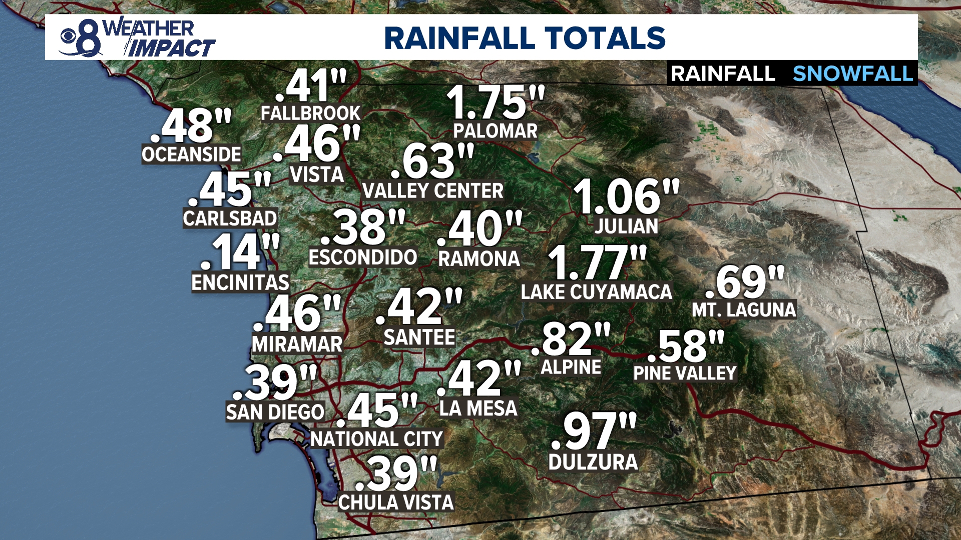
- The Inland Valleys (El Cajon, Poway, Escondido): Receive slightly more precipitation because storms drop moisture as they hit the rising elevation inland.
- The Mountains (Julian, Mount Laguna): Receive the highest rainfall totals in the county, sometimes exceeding 30 to 40 inches annually. In rare winter storms, these areas even get snow!
- The Deserts (Borrego Springs): Are in a rain shadow, receiving less than 6 inches of rain per year.
El Niño and La Niña Years
When tracking the chance of rain in San Diego over a broader multi-year timeline, ocean temperatures in the equatorial Pacific play a massive role. The El Niño-Southern Oscillation (ENSO) cycle dictates whether Southern California experiences above-average or below-average precipitation.
During an El Niño winter, the subtropical jet stream strengthens and pushes further south, often bringing atmospheric rivers and heavy downpours to San Diego. These years can result in twice the normal annual rainfall, leading to lush green hillsides, vibrant wildflowers in the spring, and occasional localized flooding.
Conversely, during a La Niña winter, the storm track shifts northward. San Diego typically experiences drier-than-average conditions, increasing drought stress and wildfire risks throughout the region.
How to Prepare for a Rainy Day in San Diego
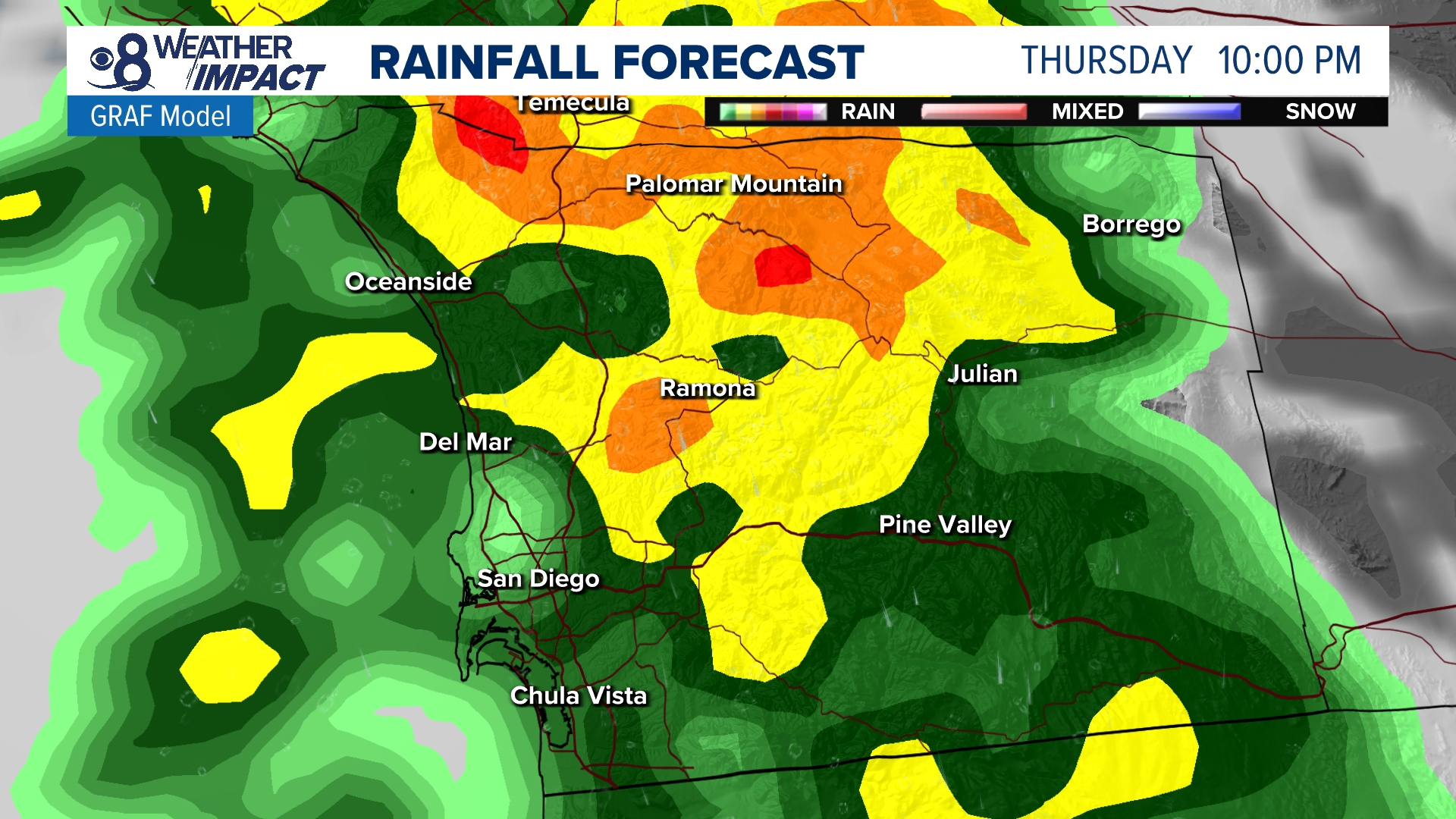
Because the city is built to handle dry weather most of the year, a sudden downpour can sometimes catch infrastructure off guard. If you check your weather app and see a high chance of rain in San Diego, keep a few tips in mind:
- Watch the roads: San Diego roads accumulate a film of oil and rubber dust during long dry spells. When the first rain hits, roads become slick very quickly. Drive slower and leave extra following distance.
- Have indoor backups: If you are visiting, keep world-class indoor attractions in your back pocket, such as the Fleet Science Center, the San Diego Natural History Museum in Balboa Park, or the New Children's Museum.
- Embrace the coast after the storm: Once a winter storm clears, the air quality is pristine, visibility is exceptional, and you can often see all the way to the Channel Islands or snow-capped local mountains.
Ultimately, while rainy days do happen, they are the exception rather than the rule in Southern California. Check your local forecast before heading out, but rest assured that sunshine is almost always just around the corner.