Colony Map: Decoding America's Founding Fathers
Introduction: Geography and Destiny in Early America

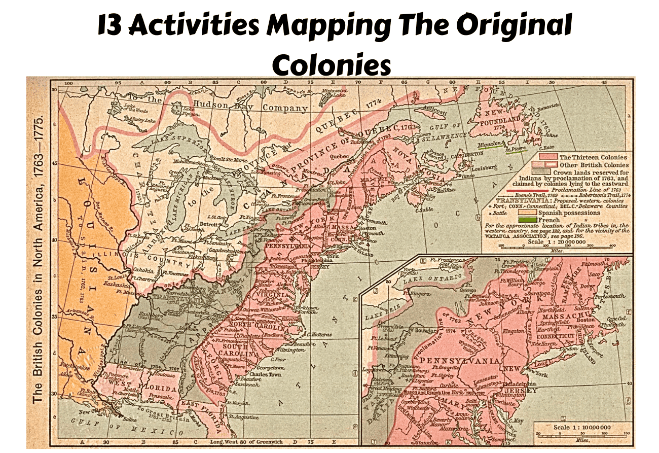
When we picture America's Founding Fathers, we often envision them gathered in Philadelphia's sweltering brick State House, debating lofty ideals of liberty, governance, and natural rights. Yet, men like George Washington, Thomas Jefferson, Benjamin Franklin, and John Adams were fundamentally products of their native soil. To truly understand their worldview, political philosophies, and the compromises that built the United States, we must look at a historical **Colony Map: Decoding America's Founding Fathers** to see how rivers, coastlines, and colonial charters shaped the minds of the revolution.
Geography in the 17th and 18th centuries was not merely a backdrop to history; it was an active participant. Boundaries dictated economies, social structures, and relationships with both Native nations and the British Crown. By mapping the colonies, we can decode the regional tensions that nearly tore the Continental Congress apart and discover why certain leaders championed specific causes.
The Three Regional Mindsets on the Map
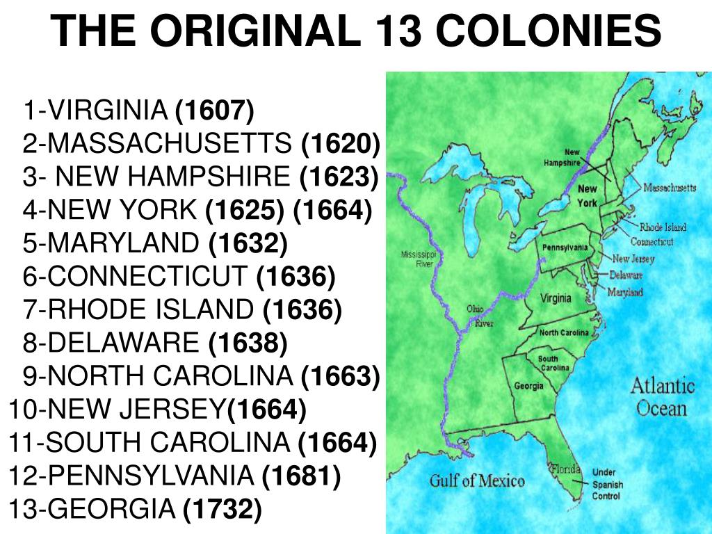
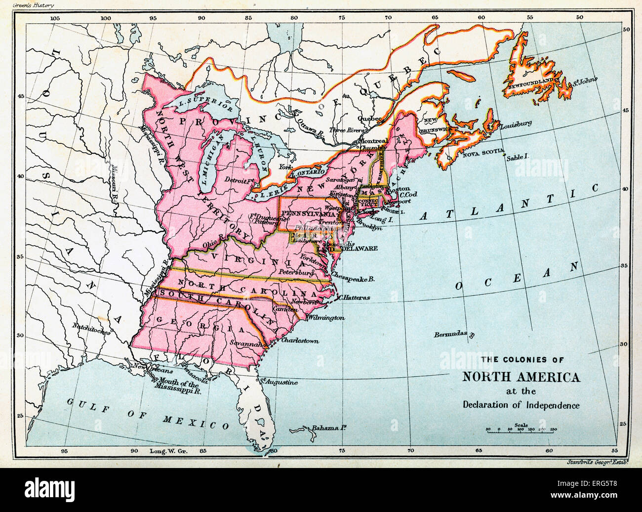
A standard 18th-century map of the Atlantic seaboard reveals three distinct colonial regions. Each fostered a radically different lifestyle, and consequently, shaped different archetypes among the Founding Fathers.
The New England Colonies: Commerce, Town Halls, and Dissent
Stretching across the rocky terrain of Massachusetts, New Hampshire, Rhode Island, and Connecticut, New England was characterized by small towns, maritime trade, and shipbuilding. Unlike the sprawling plantations of the south, New Englanders lived in close-knit communities centered around the town hall and the church.
This geography produced fierce, articulate ideologues like John and Samuel Adams. The Puritan heritage of self-governance and moral vigilance translated naturally into revolutionary zeal. New England's reliance on shipping also put it on a direct collision course with British mercantile policies like the Navigation Acts and the Stamp Act, making this region the tinderbox of the American Revolution.
The Middle Colonies: The Melting Pot of Diversity
New York, Pennsylvania, New Jersey, and Delaware formed the demographic and geographic pivot of the colonies. Crossed by major waterways like the Hudson and Delaware rivers, these colonies were agricultural powerhouses and bustling commercial hubs.
Philadelphia, situated in Pennsylvania, became the unofficial capital of the Enlightenment in America. This environment produced figures like Benjamin Franklin—a printer, scientist, and diplomat whose worldview was shaped by the urban, multi-ethnic hustle of Philadelphia. The Middle Colonies required constant negotiation among diverse religious and ethnic groups, fostering a pragmatic political culture that valued compromise over dogmatic purity.
The Southern Colonies: Aristocracy, Agriculture, and Vast Horizons

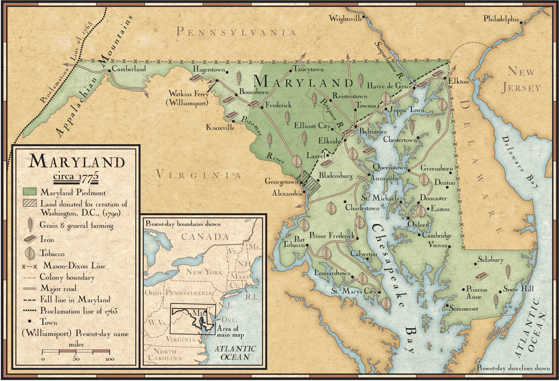
Maryland, Virginia, North Carolina, South Carolina, and Georgia occupied vast territories stretching from the tidewater coast to the rugged Appalachian foothills. Dominated by staple crops like tobacco, rice, and indigo, the Southern economy relied heavily on the plantation system and the brutal institution of chattel slavery.
Virginia alone produced four of the first five American presidents. Men like George Washington, Thomas Jefferson, and James Madison grew up on sprawling estates where they cultivated the persona of classical gentlemen-farmers. Their proximity to immense tracts of western land fueled expansionist ambitions, while their fear of centralized power stemmed from the absolute authority they held over their own plantations.
Decoding Key Figures Through Their Local Geography
To see the colony map in action, we can examine how specific founding figures were constrained and inspired by their home territories.
- George Washington (Virginia): Washington's worldview was deeply tied to the Potomac River and the western frontier. As a young surveyor and land speculator, he understood the strategic value of the Ohio River Valley. His ambition to connect the eastern seaboard to western lands informed his lifelong push for a strong, unified national infrastructure.
- Benjamin Franklin (Pennsylvania): Franklin mastered the geography of information. Operating out of Philadelphia, he sat at the intellectual crossroads between New England and the South, using his printing press to weave together disparate colonial identities into a cohesive American voice.
- Alexander Hamilton (New York): Though born in the Caribbean, Hamilton adopted New York as his home. New York's status as the rising financial capital of the hemisphere cemented Hamilton's vision for a centralized banking system, manufacturing economy, and federal assumption of state debts.
Border Disputes and Western Expansion
A critical feature of any colonial map is the uncertainty of its borders. Colonial charters granted by the British Crown frequently overlapped, leading to bitter land disputes between colonies like Pennsylvania and Virginia. Furthermore, the Proclamation of 1763 drew an arbitrary line down the Appalachian Mountains, forbidding colonists from settling west.
For Southern planters and land speculators like Washington and Jefferson, this British restriction was a direct threat to their economic future. The map, therefore, explains much of the economic motivation behind the push for independence. Breaking away from Britain meant wiping away the Proclamation line and opening up millions of acres of western territory for exploitation and settlement.
Conclusion: The Map That Built a Nation
When the delegates finally signed the Declaration of Independence and later drafted the Constitution, they were not just drafting abstract laws. They were negotiating a truce between rival geographic entities. New England merchants, Middle Colony pragmatists, and Southern planters had to find a way to stitch their diverse regions into a single map.
By studying a historical colony map, we pierce through the mythos of the Founding Fathers. We see them not as infallible demigods operating in a vacuum, but as real men shaped by the rivers they sailed, the soil they farmed, and the borders they fought to expand. Understanding their geography is the ultimate key to understanding the American experiment itself.