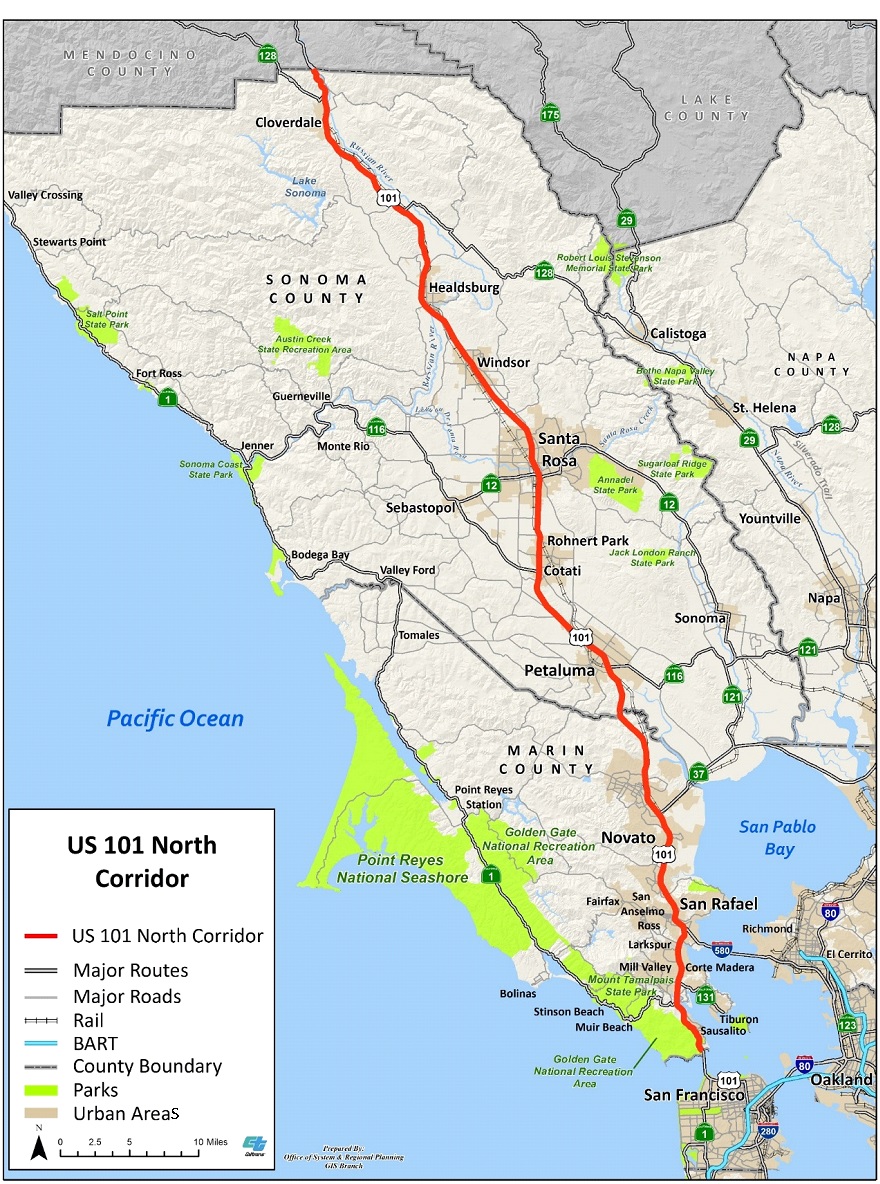
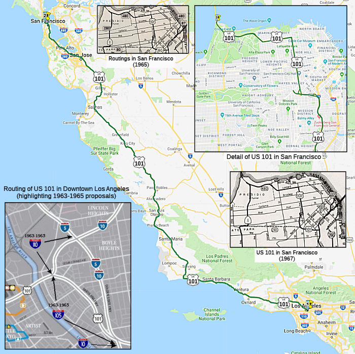
Complete Map of Highway 101: Stops & Itinerary
Planning a legendary West Coast road trip starts with understanding the route, which is why having a reliable map of Highway 101 is essential. Stretching over 1,500 miles from the rugged Olympic Peninsula in Washington down to the sun-soaked shores of Southern California, US Route 101 is one of the most scenic drives in the world.

Unlike its faster interstate neighbor I-5, Highway 101 forces you to slow down and take in the dramatic cliffs, hidden beaches, towering redwood forests, and historic seaside towns. Whether you are planning a weekend getaway or a two-week cross-coast adventure, this guide and breakdown of the route will help you navigate every mile.
Understanding the Layout: A Map of Highway 101
Spanning three distinct states, Highway 101 changes character dramatically as you travel from north to south. While sections of the route merge with Pacific Coast Highway (SR 1) in California, the true 101 offers its own unique charm, blending industrial ports, rural logging towns, and pristine state parks.
Washington Section: Rainforests and Rugged Coastlines
The northern terminus of Highway 101 begins near the town of Tumwater, south of Olympia, looping entirely around the Olympic Peninsula.
- Olympic National Park: Access world-class hiking trails, the Hoh Rain Forest, and Hurricane Ridge.
- Port Angeles: A bustling ferry hub and gateway to Victoria, British Columbia.
- Ruby Beach and Rialto Beach: Famous for dramatic sea stacks, driftwood-strewn shores, and moody Pacific weather.
Oregon Coast Section: Dramatic Sea Stacks and Historic Towns
Crossing the Columbia River via the Astoria-Megler Bridge brings you to the Oregon portion of Highway 101. Oregon’s entire coastline is publicly owned, meaning uninterrupted ocean views and accessible viewpoints are everywhere.
- Astoria: Oregon’s oldest city, known for its Victorian architecture and maritime history.
- Cannon Beach: Home to the iconic 235-foot Haystack Rock and charming art galleries.
- Oregon Dunes National Recreation Area: Massive wind-sculpted sand dunes where visitors can rent dune buggies or hike.
California Section: Redwoods to City Streets
As you cross into Northern California, Highway 101 guides you through some of the tallest living trees on Earth before winding past wine country and terminating in downtown Los Angeles.
Video: California Coast - via Pacific Coast Hwy & 101

- Redwood National and State Parks: Drive through towering ancient giants along the Avenue of the Giants.
- San Francisco: The highway crosses the magnificent Golden Gate Bridge, serving as a major artery through the city.
- San Luis Obispo and Santa Barbara: Here, the route transitions into classic Southern California beach culture with Spanish mission architecture and palm-lined streets.
Must-See Stops Along the Route
To make the most of your journey, you should pace your drive by targeting specific highlights. Depending on your timeline, you won't be able to stop everywhere, so prioritize based on your travel style.
For Nature Lovers
If your ideal trip involves national parks and outdoor recreation, focus your time on the Olympic Peninsula and the Redwood Empire. Pack waterproof layers for Washington and sturdy hiking boots for Oregon's headlands. Ecola State Park near Cannon Beach offers some of the finest coastal hiking trails in the Pacific Northwest.
For Food and Wine Enthusiasts
As you move south through Oregon and into California, the culinary scene shifts dramatically. Stop in Tillamook, Oregon, for world-famous cheese factories, and later wind your way through the Russian River Valley and Paso Robles wine regions just off the 101 corridor for exceptional wine-tasting experiences.
Practical Tips for Driving Highway 101
Navigating a coastal highway requires a bit of extra preparation, especially regarding weather, cell service, and vehicle maintenance.
- Check for Road Closures: Coastal erosion, landslides, and winter storms frequently cause temporary closures, particularly in Northern California and Big Sur. Always check state Department of Transportation (DOT) websites before setting out.
- Download Offline Maps: Cell service can be completely non-existent in dense redwood forests and remote stretches of the Washington and Oregon coasts. Download your GPS maps ahead of time.
- Drive North to South: If possible, travel from Washington down to California. This places your vehicle in the right-hand lane closest to the ocean, making it much easier to pull over safely at vista points.
By utilizing a comprehensive map of Highway 101 and planning your stops in advance, you can turn a simple commute down the coast into the ultimate Pacific road trip adventure.