Germany Rainfall Radar: Live Maps & Tracking Guide
Whether you are cycling along the Rhine, planning an alpine hike in Bavaria, or navigating a weekend commute in Berlin, a reliable germany rainfall radar is an essential tool. Central European weather is notoriously dynamic: Atlantic low-pressure systems, continental high-pressure blocks, and sudden orographic thunderstorms can alter local conditions in minutes. Knowing how to access and interpret accurate radar data ensures you never get caught unprepared in a downpour.
How Germany's Rainfall Radar Network Works
Germany possesses one of the densest and most technologically advanced weather radar networks in the world, managed predominantly by the Deutscher Wetterdienst (DWD)—Germany's federal meteorological service. Established across the country, this system tracks precipitation from the North Sea coast down to the Austrian border with exceptional accuracy.
The DWD Doppler Radar System
The backbone of Germany's rainfall observation is a network of 17 operational radar stations positioned strategically to eliminate blind spots. Each installation employs modern dual-polarization C-band Doppler radar. Dual polarization sends both horizontal and vertical electromagnetic pulses, allowing meteorologists—and automated consumer feeds—to discern not just how much precipitation is falling, but what form it takes (such as fine drizzle, heavy raindrops, hail, or wet snow).
Data Updating and Composite Scans
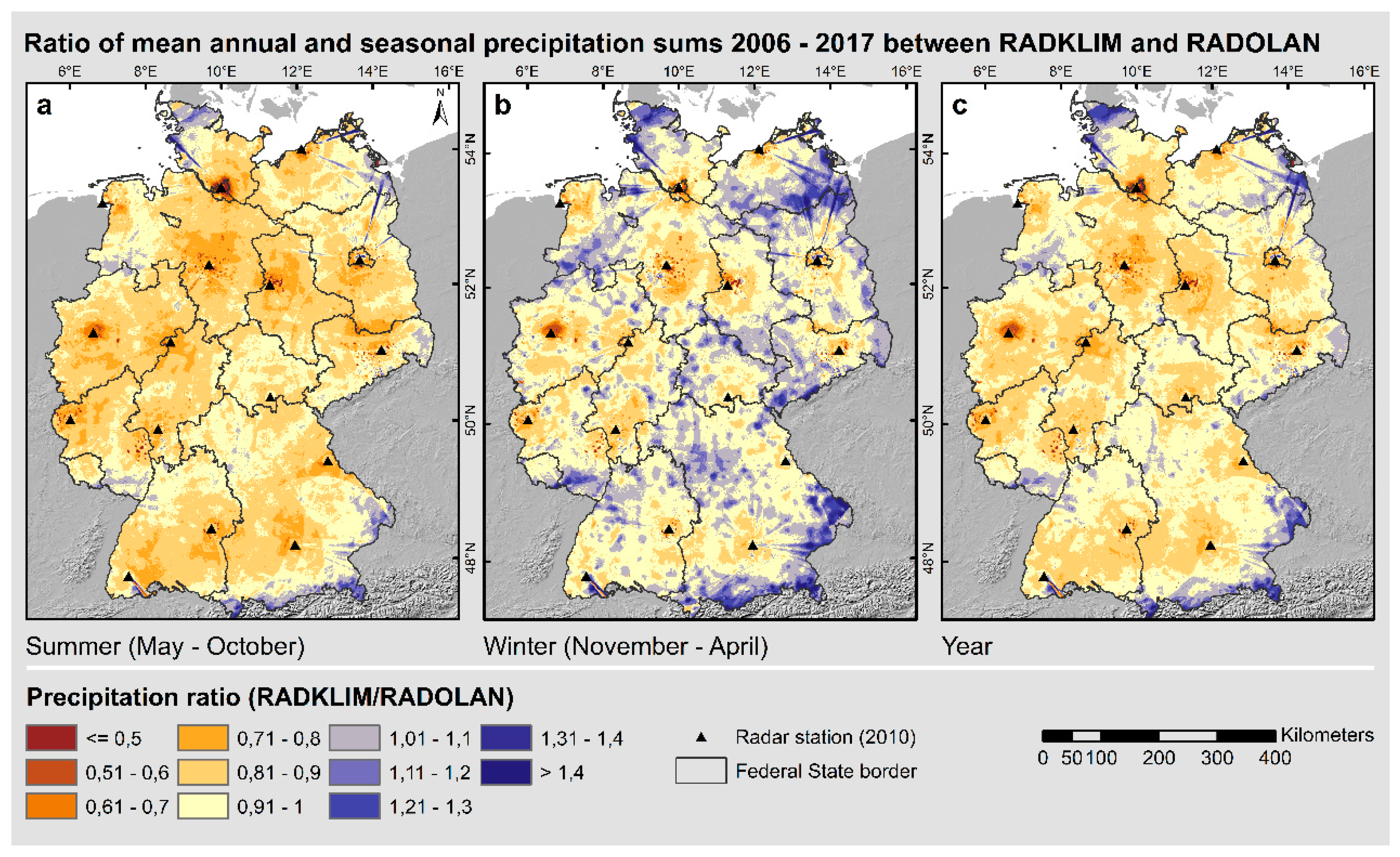
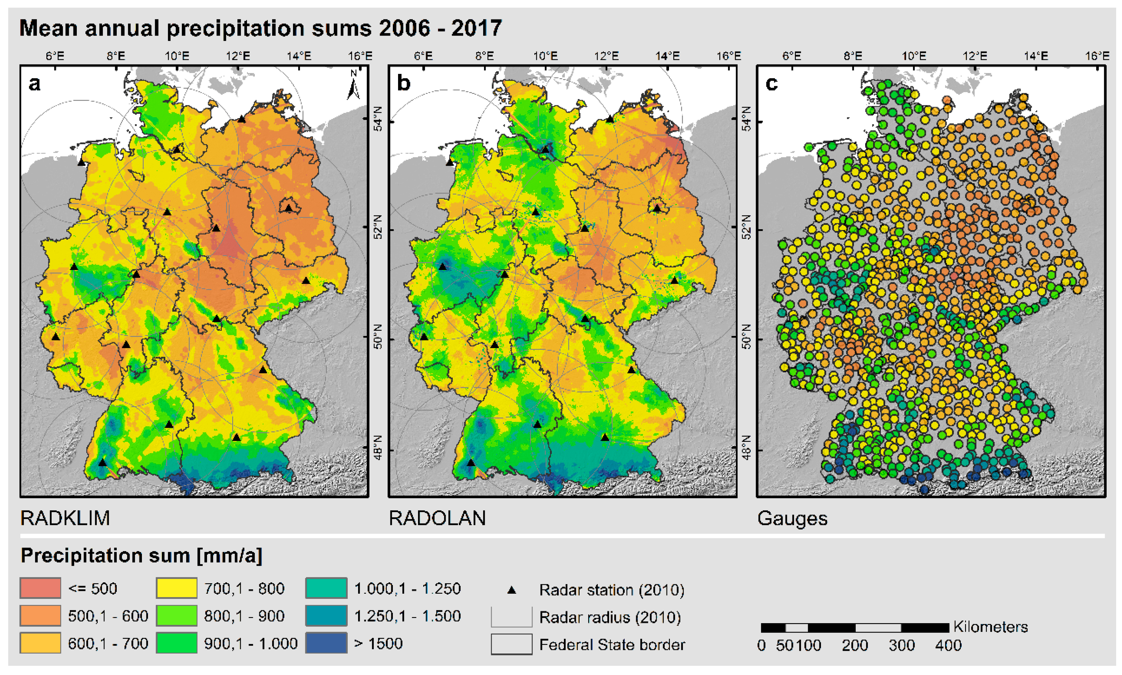
Every five minutes, all 17 stations complete full volume scans of the atmosphere within a radius of approximately 150 kilometers. The DWD software fuses these individual feeds into a seamless nationwide radar composite known as RADOLAN (Radar Online Adjusting). This processing cleans up radar noise, corrects for terrain blockages, and pairs radar reflectivity with ground-level rain gauges to calculate realistic precipitation totals per square meter.
Top Tools to Track Germany Rainfall Radar Live
DWD releases vast amounts of open data, allowing numerous platforms to display live radar. However, interface design, projection algorithms, and update speeds differ markedly between providers.
- WarnWetter (DWD App): The official application directly from the federal agency. While a German court ruling restricted the agency from offering fully free commercial weather forecasting to consumers, the low one-time in-app fee unlocks professional-grade radar overlays, lightning strikes, cloud layers, and official severe weather alerts.
- Kachelmannwetter: Founded by Swiss-German meteorologist Jörg Kachelmann, this platform is revered by weather enthusiasts and professionals. It provides ultra-high-resolution "Stormtracking" radar (down to 250-meter grid resolutions), allowing users to track microscopic precipitation cells, storm velocities, and hail likelihood in real time.
- WetterOnline (RegenRadar): One of the most popular consumer apps in Germany. Its "RegenRadar" feature provides a clean, user-friendly loop of precipitation over the previous 90 minutes and a reliable forecast projection for the next 90 minutes.
- Windy.com and Ventusky: Excellent choices for travelers and visual learners. Both combine live composite radar with ECMWF, ICON, and GFS numerical models, allowing you to cross-reference rain sweeps against wind gusts, barometric pressure, and temperature gradients.
How to Read Rainfall Radar Like a Pro
Looking at a colorful radar loop seems straightforward, but misreading visual artifacts can lead to false assumptions. Understanding how radar measures reflectivity helps you decipher what is actually happening overhead.
Deciphering Radar Colors and dBZ
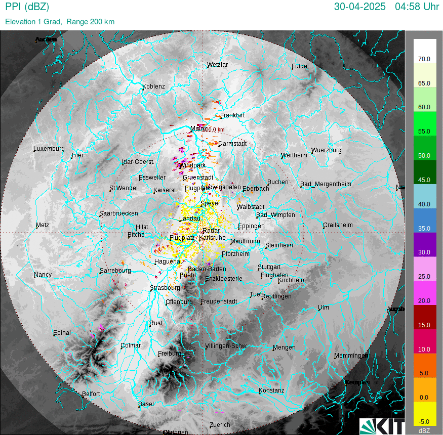
Radar does not directly measure liters of water; it measures reflectivity, expressed in decibels of Z (dBZ). Higher numbers represent denser, larger water droplets or ice particles:
Video: 🔴 Live Weather Radar | Strong Storm Cell near Palma · Lo-Fi | STORMTAPE

- Blue to Cyan (10–20 dBZ): Very light precipitation, such as mist or patchy drizzle. Often does not reach the ground in dry air.
- Green (20–35 dBZ): Light to moderate steady rain. Perfect outdoor coat weather, standard frontal rain.
- Yellow to Orange (35–45 dBZ): Moderate to heavy rain. Driving conditions deteriorate; visibility drops significantly.
- Red to Magenta (45–55 dBZ): Torrential rain or intense summer downpours. High risk of localized urban ponding and aquaplaning.
- Purple to White (55+ dBZ): Extreme severe weather, frequently indicating severe convective thunderstorms containing hail.
Common Radar Artifacts and Traps
Even advanced radar systems encounter physical limitations. Watch for these common phenomena when checking maps:
- Virga: Radar scans thousands of feet above the ground. If the lower atmospheric layer is dry, radar may show blue or green precipitation that completely evaporates before reaching your head.
- Beam Blockage: In mountainous regions like the Black Forest, Harz, or Bavarian Alps, mountain ridges occasionally block portions of the radar sweep, creating false "shadows" where it looks dry despite ongoing precipitation.
- The Bright Band: During winter or transitional seasons, falling snowflakes melt into raindrops at the freezing level. Wet snowflakes reflect radar waves much more intensely than dry snow or pure water, causing the radar to display an artificial ring of heavy red "rain" where no extreme storm actually exists.
Seasonal Patterns: Summer Storms vs. Winter Fronts
Using a rainfall radar effectively requires an understanding of Germany's seasonal meteorology.
Summer Convective Thunderstorms (Gewitter)
From May through August, Germany experiences convective storm systems. These do not arrive as uniform blankets of rain; instead, they emerge rapidly from localized heating. On summer radar displays, you will see small, circular, intense red and purple cells popping up suddenly—frequently moving from southwest to northeast. In these scenarios, a radar loop looking two hours into the past is far more informative than a standard daily forecast, as it shows where explosive storm updrafts are initiating.
Winter Frontal Systems and Snow (Schneefall)
From November through March, weather is dominated by broad, slow-moving Atlantic low-pressure fronts. These paint the radar screen in wide bands of light green and blue that drift slowly across states like North Rhine-Westphalia or Lower Saxony over several hours. When tracking winter precipitation, switch your radar application to "precipitation type" mode to distinguish whether incoming echoes will land as rain, freezing rain (Glatteis), or accumulating snow.
Integrating Radar with Severe Weather Alerts
Monitoring a live map is only one part of staying safe during extreme meteorological events. Since the catastrophic flash floods of July 2021 in Rhineland-Palatinate and North Rhine-Westphalia, Germany has revamped its multi-channel early warning infrastructure.
When tracking volatile cells on your rainfall radar, pair your observations with official warning tools:
- Cell Broadcast: Automated emergency alerts sent directly to all mobile phones connected to German cell towers in an affected district, regardless of whether you have an app installed.
- NINA and KATWARN: The federal civil defense emergency apps that push municipal-level evacuation or severe weather directives (Unwetterwarnungen).
- Länder-Hochwasserportale: Germany’s integrated flood reporting portals, which provide river gauge updates linked to radar-derived runoff models.
Summary: Getting the Most from Weather Radar
A modern Germany rainfall radar transforms raw atmospheric physics into clear, actionable data right on your screen. To make the best use of it, choose an app driven by official DWD feeds, remember that deep purple colors indicate convective hail rather than standard rain, and cross-reference your live radar checks with local civil defense alerts when storm fronts sweep across Central Europe.