Track Maine Storm Radar: Real-Time Weather Guide
When severe weather barrels toward the Pine Tree State, checking a live maine storm radar feed is often the first step in protecting your property, planning travel, or simply deciding whether to bundle up. Maine’s geographic position—tucked into the northeastern corner of the country between the cold waters of the Gulf of Maine, the Appalachian Mountains, and the storm tracks of the Atlantic coastline—makes it a magnet for volatile atmospheric clashes.

From ferocious winter nor'easters dumping feet of heavy snow to fast-moving summer severe thunderstorms along the western foothills, Doppler radar is an indispensable tool. However, interpreting radar imagery in Maine requires more than just glancing at green and red blobs on a screen. Because of radar physics, rugged topography, and complex precipitation types, getting an accurate picture takes a bit of local know-how.
The Core Radar Stations Covering Maine
The National Weather Service (NWS) operates the Next Generation Radar (NEXRAD) system across the United States. In Maine, ground coverage is anchored primarily by two dedicated WSR-88D Doppler radar sites, supplemented by adjacent installations in neighboring states and Canada:
- KGYX (Gray, Maine): Operated by the NWS Weather Forecast Office in Gray/Portland, this station covers southwestern, central, and western Maine, as well as New Hampshire. It monitors the high-population coastal corridor from Kittery up through Brunswick and Augusta.
- KCBW (Caribou, Maine): Operated by the NWS Caribou office, KCBW is the northernmost radar station in the eastern United States. It monitors Aroostook County, the central highlands, Downeast Maine, and portions of the Canadian Maritimes.
- KBOX (Taunton/Boston, Massachusetts): While based south of the state line, KBOX provides supplementary low-level views for the southernmost tip of York County.
- Canadian Doppler Radars: Environment and Climate Change Canada operates stations in New Brunswick (such as Chipman) that help track storms approaching Maine’s eastern and northern international borders.
How to Interpret Maine Storm Radar in Every Season
Radar beams scan the atmosphere by sending out pulses of microwave energy and measuring what bounces back. Rain, snow, sleet, and hail all reflect energy differently. In Maine, seasonal dynamics change how you should read these returns.
Winter: Spotting the Rain-Snow Line and "Bright Banding"
Winter storms in Maine are notorious for sharp precipitation transitions. Coastal cities like Portland, Rockland, and Bar Harbor might see cold ocean rain while communities just twenty miles inland, such as Lewiston or Bangor, are buried under heavy wet snow.
When reviewing radar during a winter storm, watch for a phenomenon known as bright banding. As snowflakes fall through a warm layer above freezing, they begin to melt. A half-melted snowflake is coated in a thin sheen of water, causing it to reflect radar energy much more efficiently than dry snow or pure rain. This appears on radar as a false band of intense precipitation (bright yellows and reds) where the freezing level sits aloft. Dual-polarization radar products like Correlation Coefficient (CC) help meteorologists confirm whether the radar is seeing pure snow, mixed sleet and freezing rain, or liquid drops.
Summer: Convective Cells and Sea-Breeze Collisions
While Maine is not in Tornado Alley, severe summer thunderstorms are common, especially in the interior and western highlands. Maine radar during the summer often tracks:
- Sea-Breeze Fronts: Cold marine air pushing inland off the Gulf of Maine often meets warm, humid air over the interior plains. On high-resolution radar, this boundary appears as a fine, low-reflectivity line that can trigger sudden, localized severe thunderstorms.
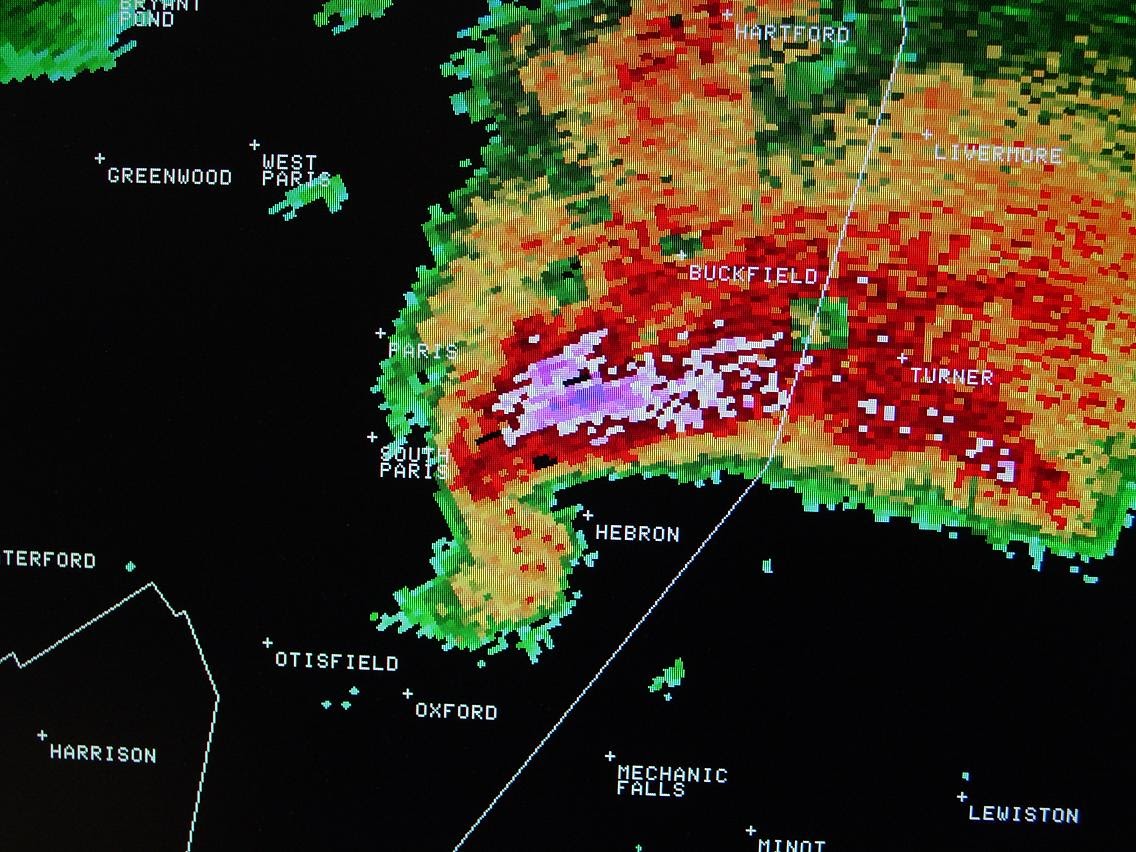
- Microbursts and Bow Echoes: Thunderstorms sweeping out of the White Mountains can organize into bow-shaped lines, producing localized straight-line winds exceeding 60 mph that easily topple Maine’s dense pine and spruce canopies.
Maine’s Radar Blind Spots: Beam Overshoot and Terrain
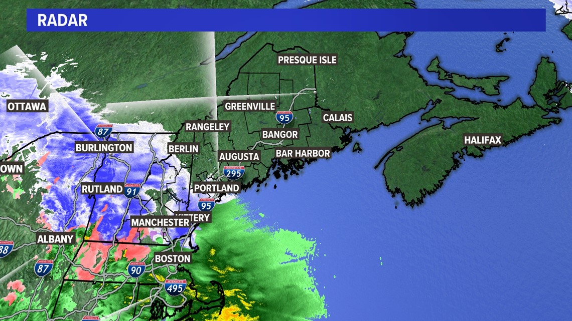
No radar network is perfect, and Maine poses unique challenges for Doppler coverage. Radar beams do not follow the curvature of the Earth; they travel in straight lines and tilt upward at a minimum angle (usually 0.5 degrees). As the distance from the radar tower increases, the beam sits higher and higher off the ground.
The North Woods and Downeast Gaps
In the vast, remote regions of northwestern Maine and parts of coastal Washington County, the nearest radar beams can be thousands of feet above sea level. This leads to beam overshoot, where shallow weather systems slip right underneath the radar:
- Shallow Snow Flurries: Cold, fluffy snow often forms in clouds low to the ground. In northern Somerset or Piscataquis County, KGYX or KCBW may shoot clean over these clouds, showing a clear screen even while snow is actively accumulating on the ground.
- Ocean Stratus and Drizzle: Dense coastal fog and drizzle along the Downeast coast frequently evade radar detection because the moisture layer is trapped within the bottom 1,000 feet of the atmosphere.
Mountain Blockage
The western mountains (including the Longfellow range and peaks around Sugarloaf and Saddleback) can physically block portions of the lowest-level radar beams, creating slight "shadows" behind the ridges where low-altitude precipitation is obscured.
Base Reflectivity vs. Composite Reflectivity
Most weather apps offer multiple radar views, but the two most common are Base Reflectivity and Composite Reflectivity. Understanding the difference helps you avoid misinterpreting the forecast.
- Base Reflectivity: Shows the radar return from the lowest elevation angle (closest to the ground). This is the best tool for seeing what is actually falling near your house, though it loses detail the farther you are from Gray or Caribou.
- Composite Reflectivity: Combines the maximum echo intensities across all vertical scan angles. This view is ideal for seeing the full vertical strength of a developing thunderstorm, but it can deceive you in winter: high composite returns might show heavy snow high in the clouds that is evaporating into dry air before reaching the ground (known as virga).
The Best Tools for Monitoring Maine Weather
If you want fast, uncompressed radar data rather than delayed, smoothed graphics, consider utilizing these platforms:
- National Weather Service Radar Page (radar.weather.gov): Provides official, high-resolution NEXRAD data with dual-polarization layers, storm warnings, and loop controls directly from the Gray and Caribou offices.
- RadarScope: A favorite of weather enthusiasts, first responders, and mariners. It displays raw, un-smoothed level 2 and level 3 NEXRAD data directly from KGYX and KCBW, allowing you to examine storm velocity and precipitation type in real time.
- RadarOmega: Another professional-grade app offering high-resolution radar, 3D volumetric views, and integrated live weather station feeds across Maine.
Staying Ahead of Changing Conditions
Maine’s microclimates mean conditions can change over a matter of miles. A coastal front can stall, a cold air damming event can lock freezing rain into interior river valleys, and ocean-effect snow squalls can develop with little advance warning. By using raw base reflectivity, cross-referencing your nearest radar station, and keeping beam overshoot in mind, you can interpret Maine storm radar with confidence and stay prepared no matter what the forecast brings.