TS Sara: History, Impact, and Meteorology Explained
Tropical cyclones remain among the most powerful and disruptive forces on Earth, shaping regional climates, economies, and emergency preparedness strategies. Among these systems, TS Sara stands out as a significant late-season tropical storm that demanded the attention of meteorologists, disaster response teams, and coastal communities alike. Understanding the lifecycle, path, and aftermath of such storms provides vital insight into modern hurricane forecasting and regional resilience.

The Meteorological Profile of TS Sara
Tropical Storm Sara formed during a particularly active period in the Atlantic hurricane basin. Late-season storms often develop in specific geographic pockets where sea surface temperatures remain sufficiently warm to fuel convection. As low-pressure disturbances organize over the warm waters of the Caribbean Sea, meteorologists monitor atmospheric steering currents, wind shear, and moisture levels to anticipate intensification.
In the case of TS Sara, the system began as a broad area of disturbed weather before consolidating into a tropical depression and quickly upgrading to a tropical storm. Forecasters utilized advanced satellite imagery, hurricane hunter aircraft reconnaissance, and numerical weather prediction models to track its erratic movement and evaluate its threat level.
Formation and Development
The genesis of TS Sara highlighted the complex interactions between tropical waves and the Intertropical Convergence Zone (ITCZ). Key factors in its development included:
- Sea Surface Temperatures: Waters exceeding 28°C (82°F) provided the necessary thermal energy.
- Low Wind Shear: Minimal upper-level winds allowed the storm's core convection to organize vertically without being torn apart.
- Abundant Moisture: High atmospheric humidity fueled persistent thunderstorms near the center of circulation.
These ingredients allowed TS Sara to maintain its structure despite interacting with nearby landmasses, a factor that often weakens developing tropical cyclones.
Path and Regional Impacts
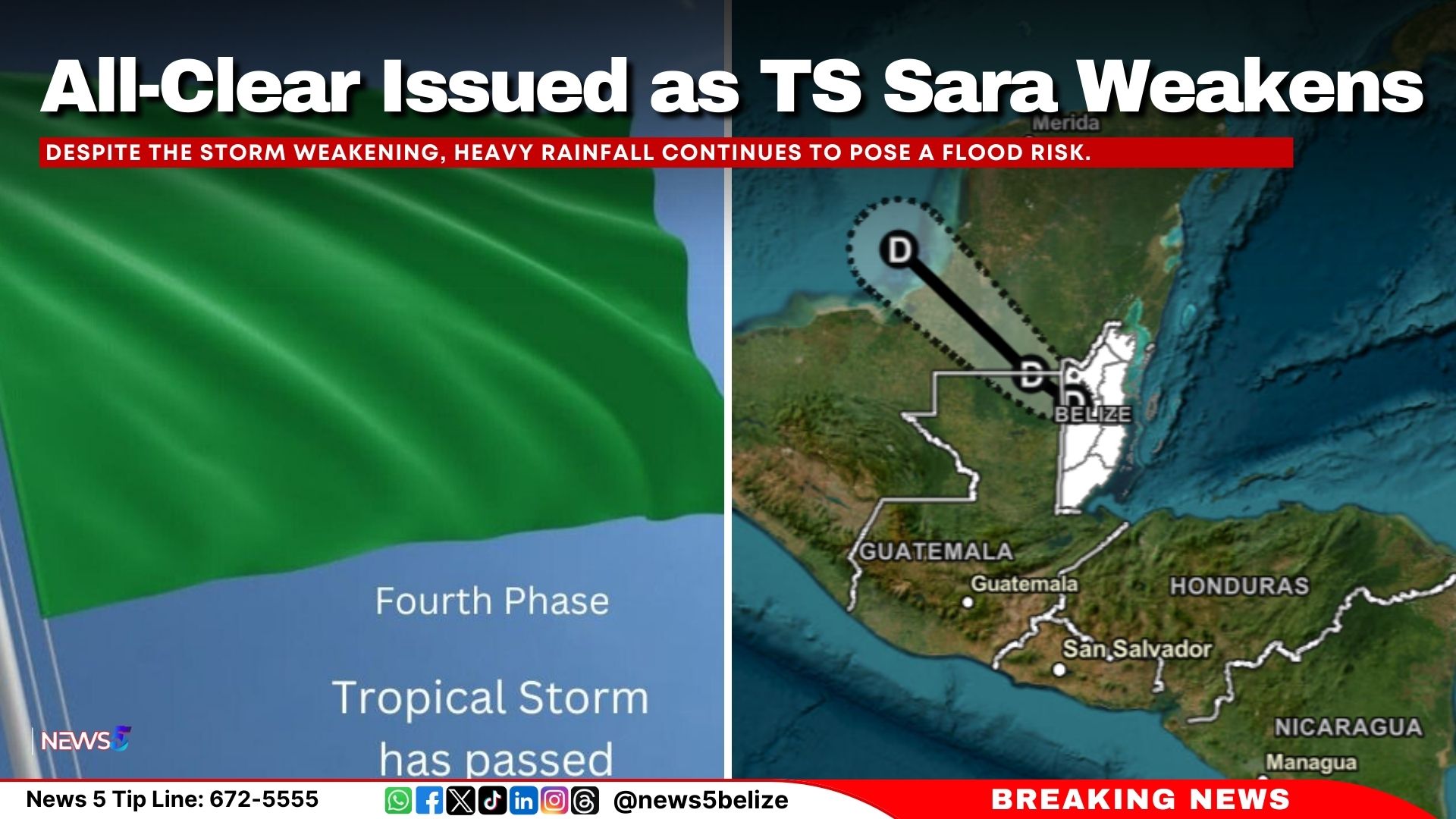
As TS Sara tracked across its designated path, it posed a severe threat to several Central American nations and parts of the Caribbean. Unlike fast-moving systems that quickly blow through a region, slow-moving storms like TS Sara often inflict the greatest damage through prolonged exposure to extreme weather.
Countries along the Caribbean coast of Central America—particularly Honduras, Nicaragua, Belize, and Guatemala—experienced the brunt of the storm. The primary hazard was not necessarily wind velocity, but catastrophic rainfall totals that accumulated over the span of several days.
Flooding and Mudslide Risks
Because TS Sara stalled or moved at a very sluggish pace, torrential downpours battered vulnerable watersheds. Major impacts included:

- River Overflows: Swollen rivers burst their banks, inundating low-lying agricultural zones and residential neighborhoods.
- Flash Flooding: Urban centers faced rapid water accumulation, overwhelming drainage systems and stranding motorists.
- Mountainous Landslides: Saturated soils on steep slopes gave way, destroying rural infrastructure and blocking vital transportation routes.
Governments in the affected regions issued red alerts, suspended school operations, and opened emergency shelters well in advance, minimizing potential loss of life.
Emergency Response and Preparedness
The threat posed by TS Sara tested the disaster management capabilities of local and international agencies. Coordination between national meteorological services, civil protection agencies, and humanitarian organizations played a critical role in mitigating the disaster's worst effects.
Early warning systems allowed communities to evacuate high-risk flood zones before rising waters cut off access roads. Search and rescue teams were pre-positioned in strategic zones, ready to deploy aquatic vehicles and aircraft as soon as conditions permitted.
Lessons Learned from TS Sara
Every major tropical system offers valuable data that helps meteorologists refine forecasting techniques. The behavior of TS Sara reinforced several key lessons for emergency planners:
- The Danger of Slow Motion: Rainfall intensity matters, but duration is often the deciding factor in catastrophic flooding. Future models must emphasize accumulation mapping.
- Infrastructure Resilience: Coastal and riverine communities require continuous investments in drainage systems, seawalls, and slope stabilization to withstand prolonged inundation.
- Public Communication: Clear, localized messaging ensures that residents understand the distinction between wind threats and water threats.
Broader Context in the Atlantic Basin
The occurrence of TS Sara underscores a broader trend of extended hurricane seasons. While the official Atlantic hurricane season runs from June 1 to November 30, atmospheric and oceanic conditions increasingly favor tropical cyclogenesis in the shoulder months. Climate scientists continue to study how rising ocean temperatures influence the frequency and intensity of late-season systems.
As maritime and coastal communities adapt to changing climatic patterns, the historical record of storms like TS Sara serves as both a warning and a blueprint. By combining cutting-edge satellite technology, rigorous meteorological analysis, and proactive community preparedness, regions vulnerable to tropical storms can better weather future crises.
Conclusion
Tropical Storm Sara left a notable mark on the meteorology of the region, reminding populations of the persistent dangers posed by tropical weather systems. From its initial formation in warm Caribbean waters to its slow, soaking march across Central America, TS Sara demonstrated the critical importance of preparedness, accurate forecasting, and resilient infrastructure. As researchers analyze the data collected during its lifecycle, the insights gained will undoubtedly contribute to safer, more resilient coastal regions in the years to come.