Weather Radar Windham Maine: Track Local Storms
When living in or visiting the Sebago Lake region, keeping an eye on the sky is a daily routine. From sudden summer squalls rolling off the mountains to heavy nor'easters dumping feet of snow in the winter, local conditions change rapidly. For residents and visitors alike, consulting weather radar Windham Maine is the best way to stay informed, protect property, and plan outdoor activities safely.

Whether you are commuting along Route 302, boating on Sebago Lake, or simply trying to figure out if you need an umbrella, understanding how to read and access local meteorological data is essential. This guide covers the best tools available for tracking storms in Windham and Cumberland County.
Understanding Weather Radar Windham Maine
Windham does not have its own standalone Doppler radar tower within town limits, but it sits directly in the coverage zone of several regional National Weather Service (NWS) radar sites. The primary radar station covering southwestern Maine is typically KGYX, located in Gray, Maine, just a few miles south of Windham.
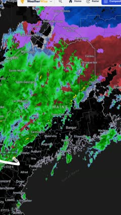
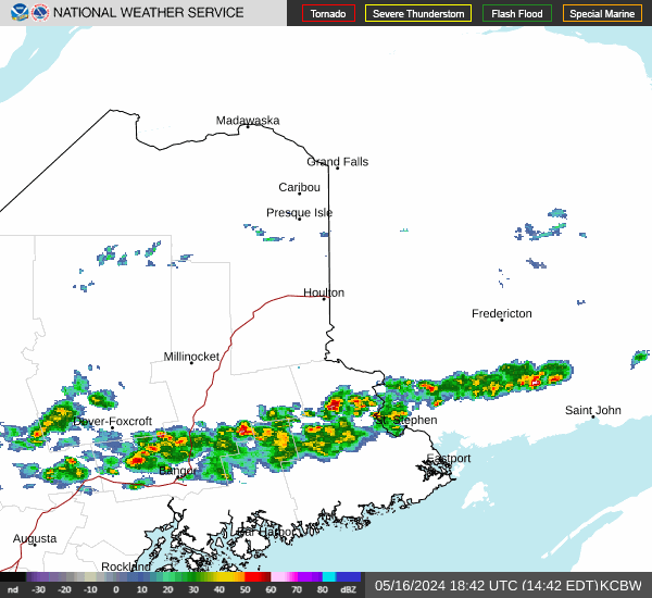
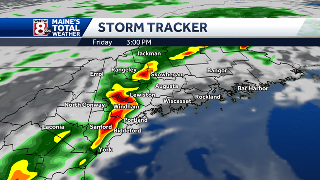
Because of this close proximity, radar imagery for Windham is exceptionally high-resolution. Meteorologists and everyday citizens can view real-time precipitation returns, wind velocity, and storm movement with minimal delay. When a severe thunderstorm warning is issued for Cumberland County, the Gray radar station provides minute-by-minute updates on storm intensity, hail potential, and rotation.
Top Tools for Live Radar Tracking
With dozens of weather apps and websites available, it can be overwhelming to choose the right one. To track precipitation accurately in Windham, consider using these trusted platforms:
- National Weather Service (weather.gov/gyx): The official source for government-issued watches, warnings, and raw radar loops. It is completely free and ad-free.
- RadarScope or Radar Omega: Professional-grade apps favored by weather enthusiasts. They pull raw NEXRAD data directly from the Gray radar station, offering velocity and dual-polarization products.
- Local TV Station Apps: Channels based in Portland (such as WGME, WMTW, and NEWS CENTER Maine) offer localized apps tailored specifically to Southern Maine geography, including town-by-town alerts for Windham.
Interpreting Radar Colors and What They Mean
When you pull up a live radar map for Windham, you will see a spectrum of colors indicating different types and intensities of precipitation. Knowing how to read these colors helps you gauge whether you are facing a light drizzle or a torrential downpour.
Rain vs. Snow in Colder Months
In the transition seasons of spring and autumn—and throughout the freezing Maine winter—radar interpretation requires a bit of local context. Standard base reflectivity shows falling precipitation, but it does not always tell you whether it is rain, sleet, wet snow, or freezing rain.

- Light Green: Usually indicates light rain or flurries. In winter, this might mean a dusting of dry snow.
- Yellow to Orange: Moderate to heavy rain, or steady, heavy snowfall accumulation rates (often 1 to 2 inches per hour).
- Red to Bright Pink/White: Severe thunderstorms, heavy downpours, potential hail, or intense convective snow bands during winter storms.
During winter events in Windham, always cross-reference radar imagery with current surface temperatures. A bright yellow return might look alarming, but if temperatures are sitting at 28°F, that moisture translates to heavy, accumulating snow rather than rain.
Severe Weather Risks in Cumberland County
While Maine is rarely impacted by tropical systems at full strength, the region faces distinct severe weather threats throughout the year. Monitoring radar is critical during these specific scenarios:
Summer Thunderstorms
Hot, humid summer days frequently trigger pop-up thunderstorms fueled by moist air moving inland from the Atlantic Ocean and Gulf of Maine. These storms can produce frequent lightning, localized flash flooding in low-lying areas near local brooks, and damaging straight-line winds that knock out power across Windham neighborhoods.
Winter Nor'easters
Nor'easters bring heavy moisture wrapping around low-pressure systems moving up the Atlantic coast. Radar helps forecasters determine where the rain-snow line will set up. Windham often sits right on that precarious boundary, making real-time radar crucial for anticipating whether an event will bring heavy snow, ice, or a messy mix.
Tips for Staying Safe and Prepared
Technology makes it easier than ever to track storms before they arrive at your doorstep. To make the most of weather radar tools in Windham, keep these best practices in mind:
- Enable Push Notifications: Set up your preferred weather app to send severe thunderstorm or winter storm warnings directly to your phone for Cumberland County.
- Watch the Direction of Movement: In New England, weather systems typically travel from west to east or southwest to northeast. Check the radar loop animation to see if a storm heading toward Gorham or Standish is tracking directly toward Windham.
- Have a Backup Power Source: Severe storms frequently knock out power lines in wooded Maine towns. Keep a battery-powered or hand-crank NOAA weather radio handy when the radar indicates a major system is approaching.
By staying informed and utilizing accurate local radar data, you can navigate Windham's changing weather with confidence all year round.