Wunderground Weather Forecast: Features & Guide
When planning your week, checking the local conditions is essential, and millions of people rely on the Wunderground weather forecast to stay prepared. Weather Underground (often called Wunderground) has built a stellar reputation among outdoor enthusiasts, gardeners, pilots, and everyday commuters. Unlike standard weather apps that pull data from a single regional airport, Wunderground taps into a massive, crowdsourced network of personal weather stations.

This article explores how the platform works, how to read its detailed forecasts, and how you can maximize its features to plan your daily activities with confidence.
Understanding the Wunderground Weather Forecast System
The core strength of Weather Underground lies in its hyper-local approach. Traditional meteorology relies heavily on government-run stations spaced tens of miles apart. Wunderground bridges these gaps by incorporating over 250,000 personal weather stations (PWS) owned by hobbyists, schools, and communities worldwide.
When you look up your neighborhood on the platform, you aren't just seeing a generalized regional prediction. You are seeing data collected right down your street or from the nearest compatible backyard sensor. This hyperlocal focus provides significantly better accuracy for microclimates—such as coastal fog banks, valley frost pockets, and urban heat islands.
Key Features to Explore
To get the most accurate insights from your daily check-ins, it helps to understand the suite of tools available on both the desktop site and mobile applications.
1. The Smart Forecast and Hourly Graphs
The main dashboard presents an immediate snapshot of current conditions, including temperature, real-feels (wind chill or heat index), humidity, dew point, and barometric pressure. Below the summary, you will find:
Video: The Weather App to Rule Them All: Ranking Wunderground, AccuWeather, Windy, Weather Channel, others

- 10-Day Outlook: Long-range planning details covering high/low temperatures and precipitation chances.
- Hourly Tables: Scrollable hourly breakdowns showing wind speed, wind direction, rain accumulation estimates, and cloud cover percentages.
- Graph Views: Visual charts that map temperature trends and precipitation probability over time, making it easy to spot when a cold front will hit.
2. Interactive Radar and Satellite Maps
Wunderground offers some of the most robust mapping tools in consumer meteorology. Users can toggle between multiple map layers to track storms in real-time.
- NEXRAD Radar: High-resolution base reflectivity and velocity data to spot rain, snow, and severe storm rotation.
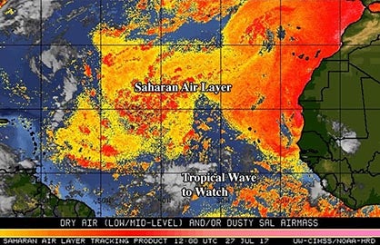
- Global Satellite: Infrared and visible satellite imagery to monitor cloud movements across continents.
- Active Fires and Air Quality: Essential layers during wildfire season or high-pollution days, displaying smoke plumes and local Air Quality Index (AQI) scores.
3. Personal Weather Station Integration
If you own a compatible weather station (such as units from Davis Instruments or Ambient Weather), you can link it directly to the platform. Contributing your data helps your entire neighborhood enjoy better forecasting accuracy while earning you ad-free access to the platform.
Tips for Getting the Most Accurate Results
Because Wunderground relies on crowdsourced data from private sensors, accuracy can occasionally vary if a specific station is improperly calibrated or obstructed. Keep these tips in mind:
- Check the Station ID: Look below the main temperature reading to see which specific PWS is feeding your current view. If a reading looks suspiciously high or low, click on the station name to check its elevation or surrounding environment.
- Compare Nearby Sensors: In dense urban areas, you can toggle between several nearby stations to cross-reference data and ensure consistency.
- Utilize the App Alerts: Set up severe weather push notifications for your precise GPS coordinates so you receive timely warnings about flash floods, high winds, or severe thunderstorms.
Conclusion
The Wunderground weather forecast remains a powerful resource for anyone who needs hyper-local, detailed meteorological data. By moving beyond simple generalized forecasts and tapping into a vast community of weather observers, it delivers the precision required for work, travel, and outdoor recreation. Spend a few minutes exploring its interactive maps and hourly graphs, and you will quickly master the tools needed to stay ahead of the elements.